submitted by Samuel Bendett
(CLICK HERE TO ENLARGE IMAGE)
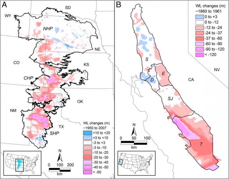
Groundwater depletion has been most severe in the purple areas indicated on these maps of (A) the High Plains and (B) California's Central Valley. These heavily affected areas are concentrated in parts of the Texas Panhandle, western Kansas, and the Tulare Basin in California's Central Valley. Changes in groundwater levels in (A) are adapted from a 2009 report by the U.S. Geological Survey and in (B) from a 1989 report by the USGS.
Homeland Security News Wire - May 29, 2012
The U.S. food supply may be vulnerable to rapid groundwater depletion from irrigated agriculture; for example, from 2006 to 2009, farmers in the south of California’s Central Valley depleted enough groundwater to fill the U.S. largest man-made reservoir, Lake Mead near Las Vegas — a level of groundwater depletion that is unsustainable at current recharge rates
Problem, Solution, SitRep, or ?:


Recent Comments